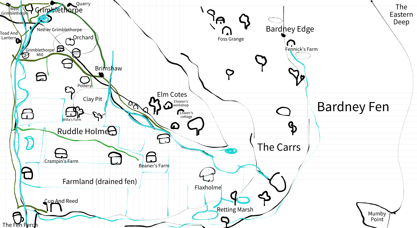
Grimbles How is a limestone ridge forming the central landmark of a small region to which it lends its name. To south and west lie fertile clay lowlands and drained fens. To the north and east, wet woodlands create a sparsely inhabited wilderness, giving way to Bardney Fen (part of The Shrouded Fens), and past that, the sea. To the northwest, the ridge ascends to the plateau of Crumble Top, which serves as the primary route for locals and traders entering and leaving the region.
The area includes several small settlements, such as Haxthwaite, the Grimblethorpe villages, Brimshaw, and Ruddle Holme. The ridge provides well-drained ground suitable for coppicing, small-scale farming and craft trades, while the surrounding lowlands support mixed cropping and fen-edge agriculture.
Key features include The Cup and Reed trading post, small inns, and local industries like pottery and lime-burning. The slopes of Grimbles How are home to both Elowen Hale and Lowen Foss.